
Wildflowers, waterfalls, endless views, and the return of our summer birds — sounds like spring in the Adirondacks! Anyone who hikes here knows there’s a huge variety of trails, but in spring we try to stay off paths that go over 3,000 feet in elevation to let them dry out. It’s a great way to protect our forests, and with so many low-elevation hikes available it’s a great time of year to see some of those magnificent places.
So what’s your pleasure? Read on to learn our favorite hikes for bird watching, standing on a summit, climbing an Adirondack fire tower, seeing some waterfalls, or just taking it easy.
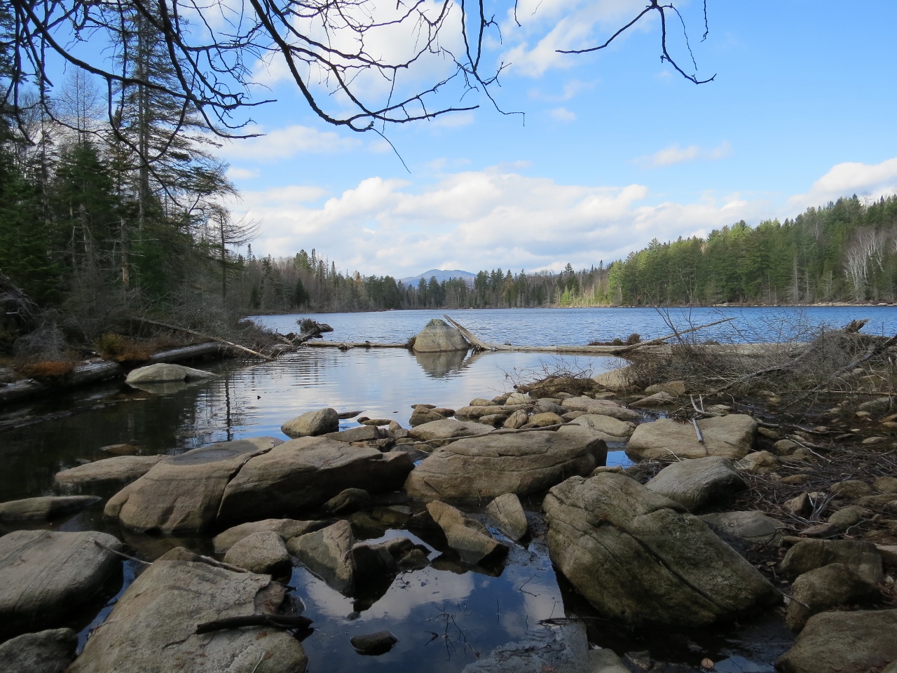
Fire tower hike: Owl's Head Mountain
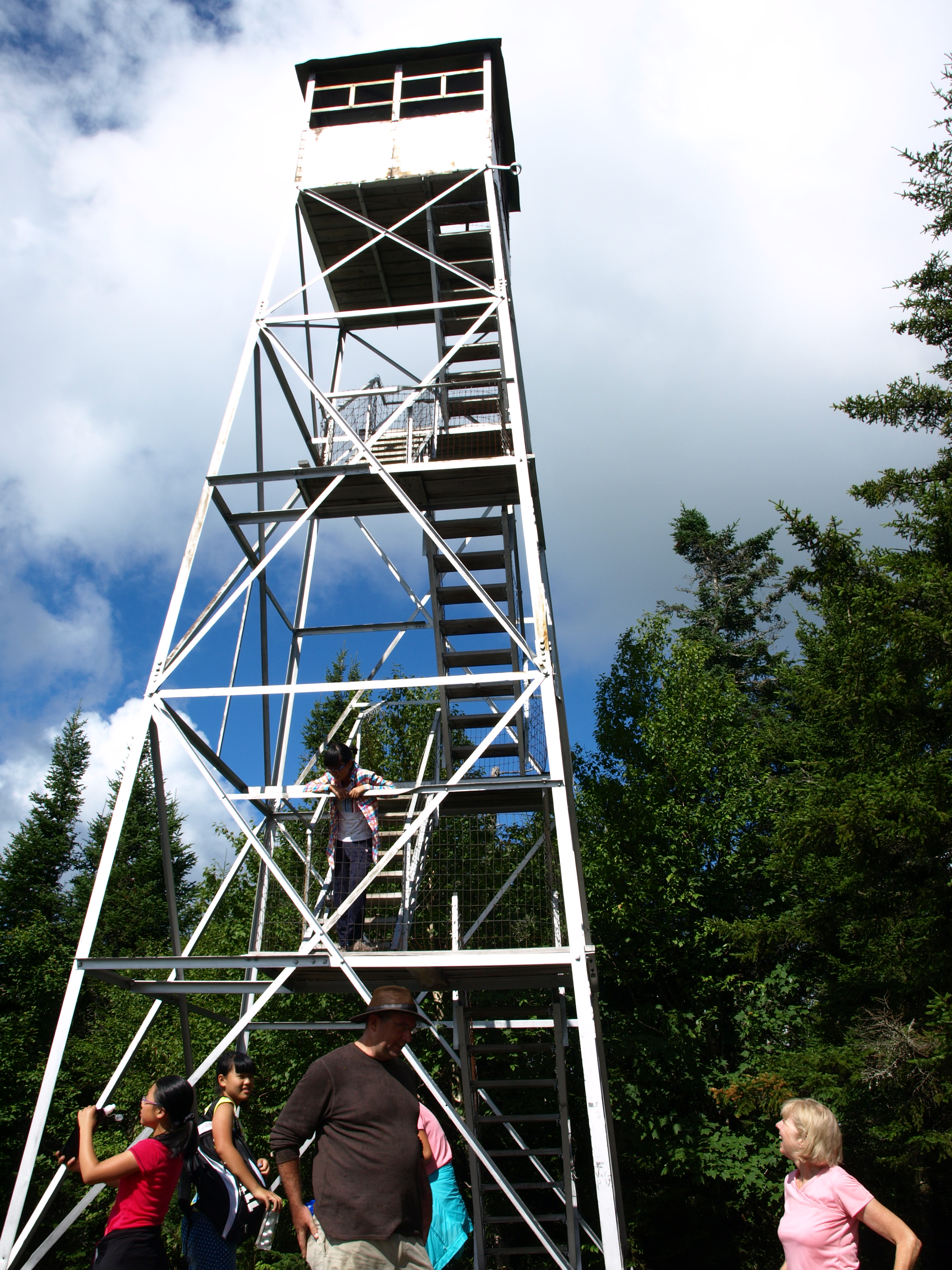
There are a bunch of Owl's Head mountains in the Adirondacks, but none look like their namesake bird quite as much as the one in Long Lake. This prominent peak has four summits, two of which form the feather tufts found on great horned owls. The highest point is where the restored fire tower — the original was built in 1919 — can be found. If climbing the tower scares you, don’t fret. There are excellent views from the summit cliffs. But if you do decide to ascend the tower, you’ll be greeted by a 360-degree view of the Central Adirondacks and the High Peaks in the distance.
Getting there
From the intersection of Route 28 and Route 30 in the town of Long Lake, follow Route 30 toward Tupper Lake. Continue for about 2 miles and turn left on Endion Road, then follow that for 2 miles. The trailhead and parking area for Owl's Head are on the right.
Stats
Distance: 3.1 miles one way
Elevation: 2,812 feet
Ascent: 1,200 feet
Summit hike: Rocky Mountain hike
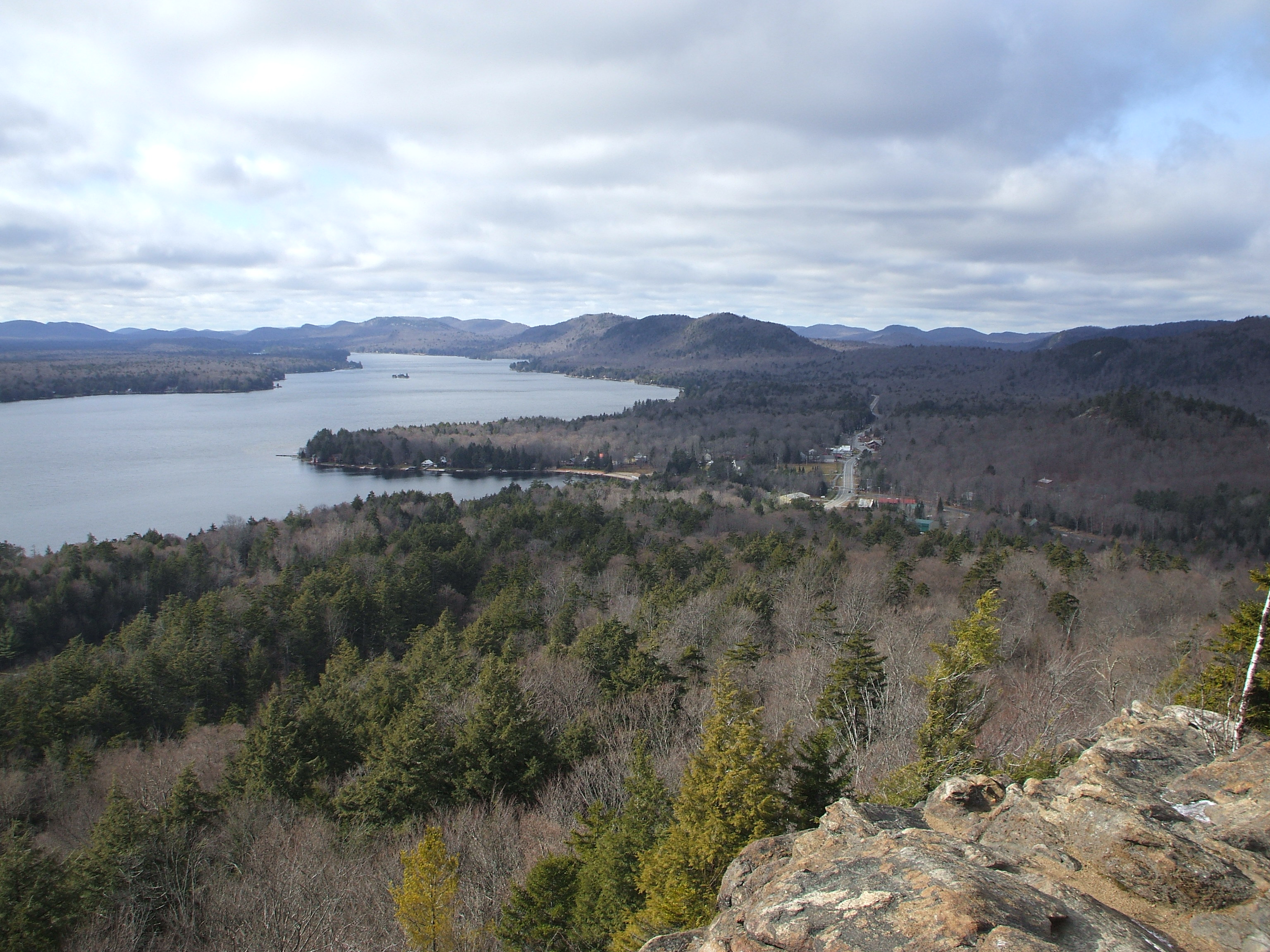
This easy half-mile hike awards fantastic views that are especially nice during sunrise and sunset — just be sure to pack a head lamp. As the name implies, the top of Rocky Mountain is in fact rocky. Simply scrabble up the short, steep trail to gain the ridge, then continue along that mostly level stretch to the summit, where there is a view of the Fulton Chain of Lakes.
Getting there
Drive west along Route 28 from Inlet, toward Old Forge, and you'll see the parking area on the right.
Stats
Distance: It's only a half mile from Route 28 to the summit
Elevation: 2,205 feet
Ascent: 475 feet
Waterfall hike: Auger Falls loop
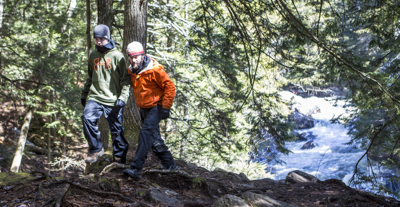
The Auger Falls loop begins and ends on a gravel road. Simply park, follow the road in, then take the path on the left to begin the loop. Before long the 40-foot falls will be in earshot, then they’ll be in full view from an overlook. Be careful hiking along the top of the hemlock-lined gorge, as it can be slippery. Follow the trail and enjoy this scenic stretch of river before looping back to the road. Turn right to head back to the parking area.
Getting there
From the intersection of Route 30 and Route 8 in Speculator follow Route 8/30 toward Wells. Continue for just under 8.5 miles to a unmarked gravel road on the left.
Stats
Distance: 1.25 miles
Nature walk: Sacanadaga Pathway
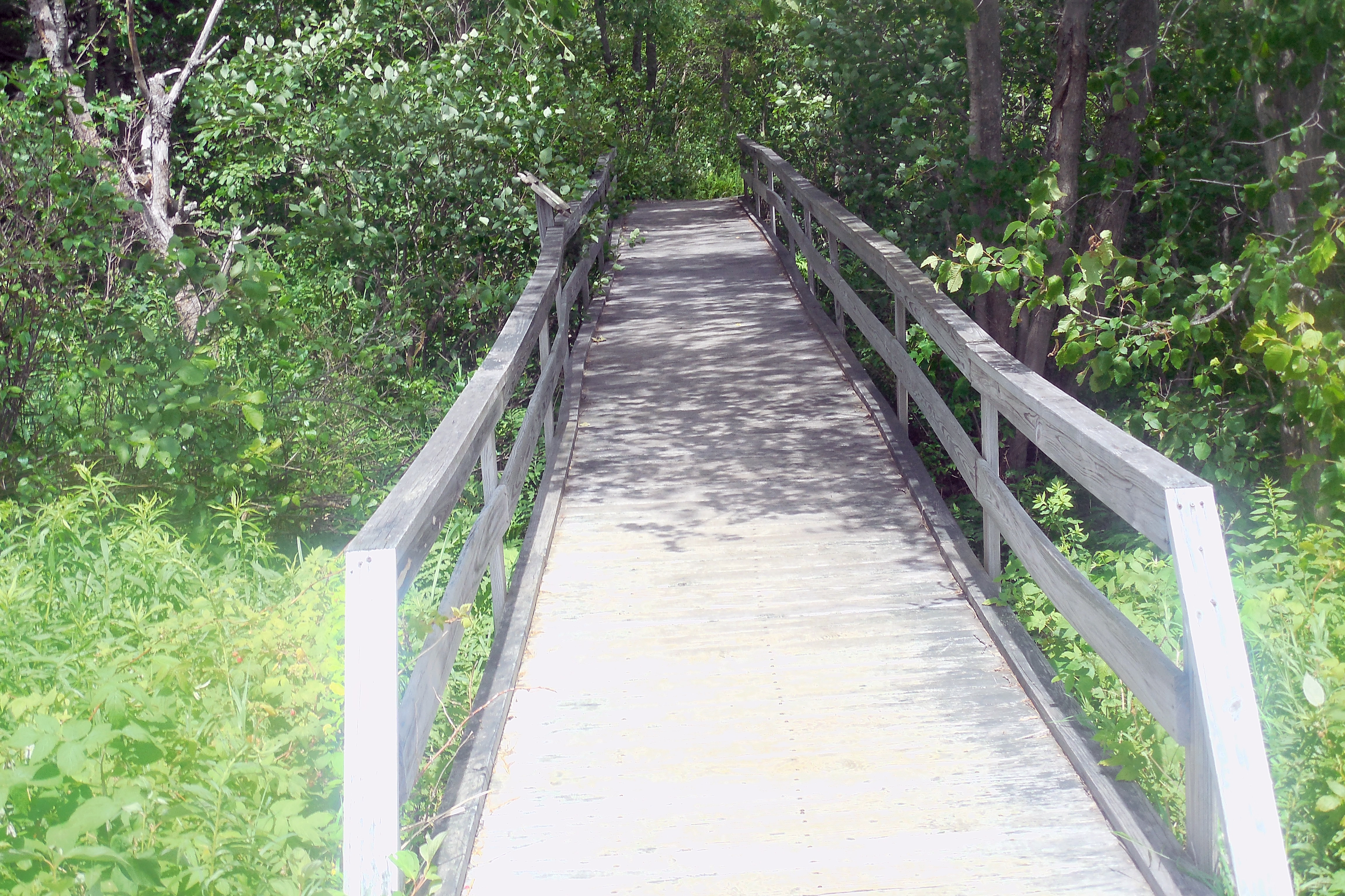
The Sacandaga Pathway is a lovely, 1.5 mile long boardwalk through wetlands, transitional forest, and upland timber areas that’s accessible to all fitness levels. Interpretive signs identify some of the unique plants that live in the wetland — did you know the Adirondacks is home to two carnivorous plants? — and a picnic area with grills, and the restrooms in the pavilion, make it easy to justify spending the day here.
Getting there
The path is located in Speculator, on Route 30 just south of its intersection with Route 8. Look for the large parking area that's across from the beach.
For the birds: Chain Lakes Road South
This isn’t so much a scenic hike as it is a network of hiking trails that begin on Chain Lakes Road South, all of which are worth exploring. The destinations from the three parking areas include Clear Pond, Cedar River, Pine Lake, and the Hudson River — yes, that Hudson River! Most of the trails are on old dirt roads, so they’re generally wide, easy to follow, and never steep. The Hudson is one of the shortest hikes, most can do it in 15 minutes or so, and the trail to Pine Lake is the longest, so plan a few hours for that one. Along the way you’ll find wetlands, and deciduous and coniferous forests.
Getting there
From the intersection of Routes 30 and 28 in Indian Lake, proceed 1.3 miles east on Route 28 to Chain Lakes Road South on the north side of the highway and on the west side of Lake Abanakee. There are three parking areas reached at 3, 3.8, and 5.3 miles from Route 28. The third parking lot is only open during big game hunting season. The main parking area is 3.8 miles in; there is a metal gate to prevent any further driving. There is enough room for about five cars and if this lot is full, you need to drive back to the first parking lot.
Stats
Elevation: It ranges from 1,530 feet to 1730 feet. There are a few gentle hills, but no steep terrain.
Distances: There are three different parking areas; these distances are from the main parking area 3.8 miles down Chain Lakes Road South from Route 28. Hikers should adjust the estimates if parking at the first lot, which is 0.8 mile farther away, or the third lot, which is 1.5 miles closer.
- Hudson River: 0.1 mile
- Clear Pond: 1.6 miles
- Cedar River: 2.8 miles
- Pine Lake: 3.6 miles
Experience the Adirondacks by kayak, on foot, or by whitewater raft — or make a weekend out of it and try all three!