Auger Falls Loop
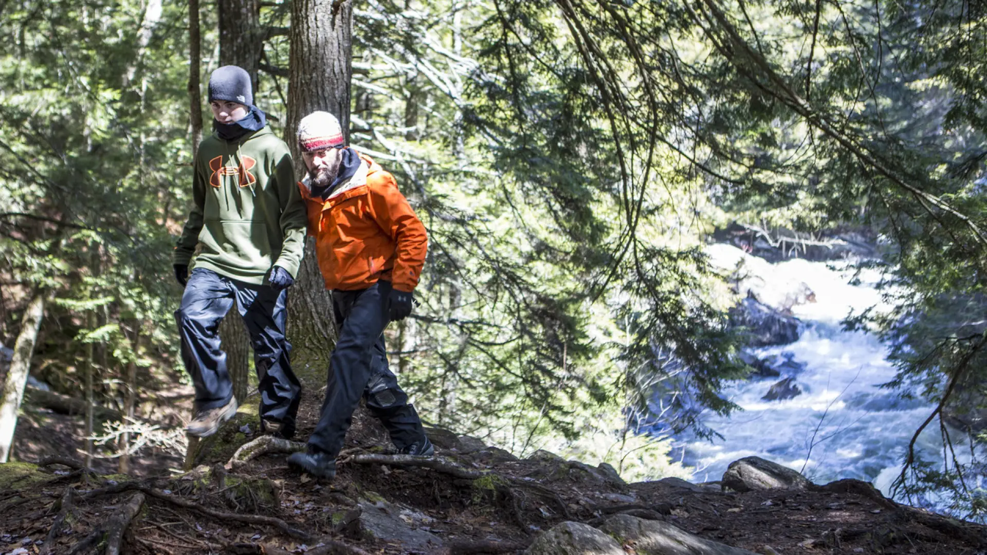
This quick hike to Auger Falls along the Sacandaga River is sure to please any member of the family. Remember to be cautious on the steeper slopes near the falls. Take a short trip just to see the falls or go for a longer loop hike around the area. This hike is part of the Waterfall Challenge.
Key takeaways
- Distance (out and back option): 0.8 miles round trip
- Elevation gain (out and back option): 75 feet round trip
- Distance for the loop: 1.25 miles round trip
- Elevation gain for the loop: 160 feet round trip
- Hike includes trail junctions, unmarked trail, and a road walk
Hiking Auger Falls
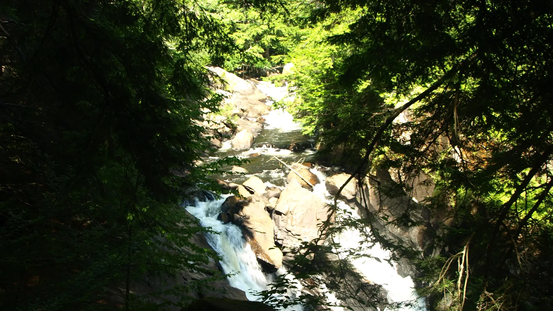
The trail from here is well trodden and marked and will descend to an amazing overlook of the falls. Be very careful here, there are sheer ledges and it can be quite slippery. Below the falls is a popular swim hole and a herd path access it, but again this can be very dangerous and slippery, tread with caution. The marked trail ends at an old fireplace 0.4 miles from the trailhead.
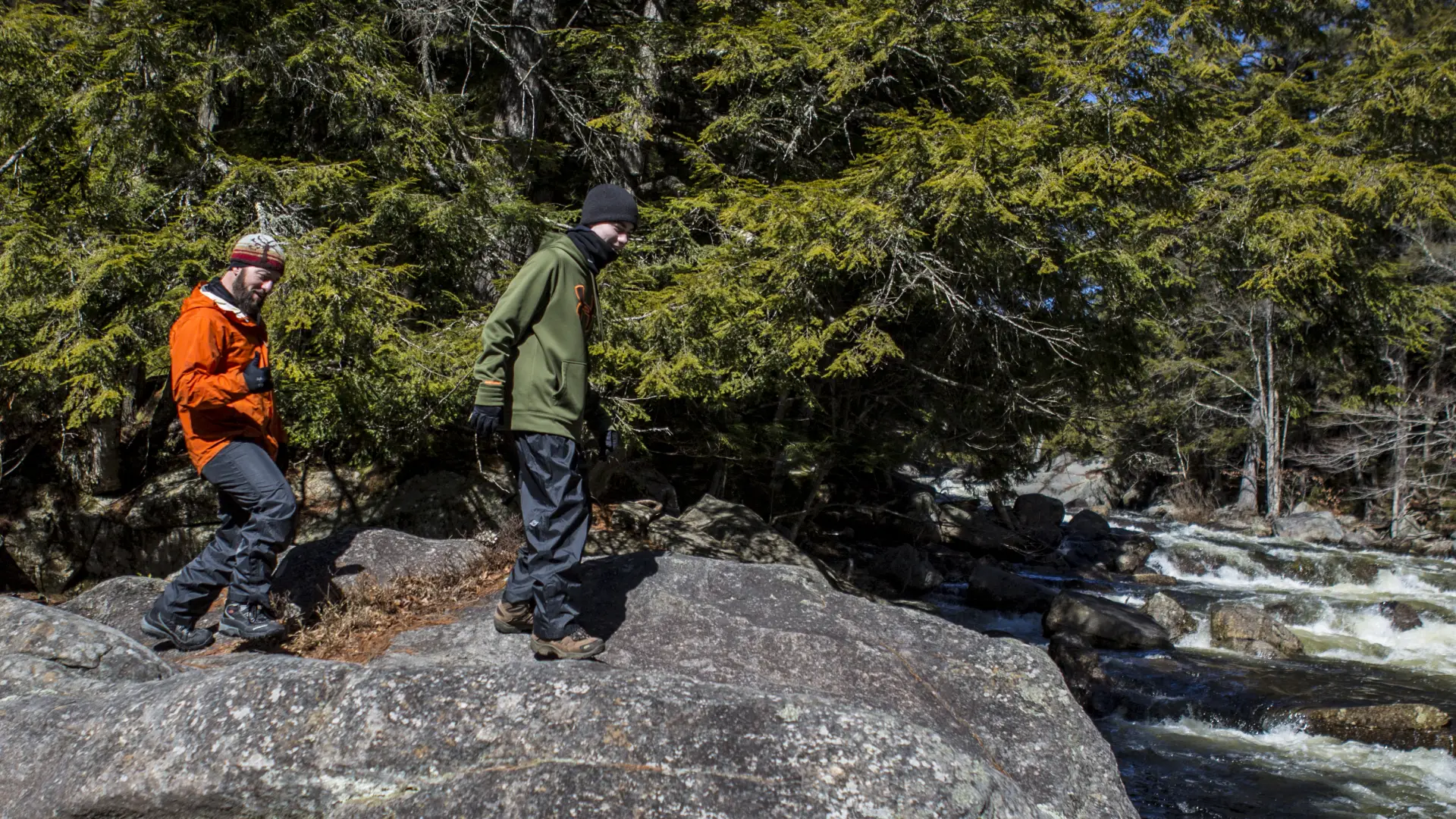
The trail continues along the river and eventually becomes unmarked by DEC trail disks. However, it is well used and not hard to follow. It is very obvious and follows closely along the scenic river upstream. Eventually the trail breaks free from the shore and accesses the other side of the gravel road which you will follow left to get back to your car.
Auger Falls in the winter
This trail would be fine for snowshoeing or crosscountry skiing, but unless there is a heavy snow, microspikes or other traction devices might be more appropriate for near the possibly slippery rocks. Being prepared is necessary for any winter hike.
Experience more trails in Hamilton County
Looking to find some more trails to hike in Hamilton County? With hundreds of miles of trails, we can help you find more amazing hikes in the big outdoors.
How to get there
From the intersection of Route 30 and Route 8 in Speculator follow Route 8/30 toward Wells. Continue for just under 8.5 miles to an unmarked gravel road on the left. The trailhead is a former picnic area.
Auger Falls Loop
Just a quick hike to Auger Falls along the Sacandaga River is sure to please any member of the family! Take a short trip just to see the falls or go for a longer loop hike around the area. You can't go wrong.